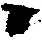
Road Map of A Coruna City Galicia Spain
Printable A Coruna map showing the city in the region of Galicia, Spain. Map of A Coruna.
 |
Street Map A Coruna City Centre Galicia Spain
A Coruna City Map: Comprehensive Google road map of A Coruna city, providing its location in the province of A Coruna, Galicia, Spain.
- Interactive Road Map A Coruna Spain.
- Zoomable A Coruna Map Galicia, Spain.
- See A Coruna City in Satellite Mode.
- View Any A Coruna Roads in Street View*.
- One of Clearest A Coruna Maps Available.
- This A Coruna Road Map is Easy to Print.
- Easily Find A Coruna Hotels & Services.
- Locate A Coruna Attractions & Facilities.
- Find Businesses and Restaurants in A Coruna.
- See A Coruna Area in Google Earth.
- Detailed A Coruna Street Map, Spain.
- Detailed Road/Street Map A Coruna, Galicia.
- Find Links to Other Local Road & Street Maps.
Things you will spot in and around the A Coruna, Galicia area: San Vicente de Elvina, Port of A Coruna, Centro, As Roseiras, San Pedro de Visma, A Coruna Railway Station, Aquarium Finisterrae, Torre de Hercules, Monumento a los Fusilados de la Republica, Perillo, Cabreira, Dorneda, Acea de Ama, Matogrande, Mesoiro, Arteixo, Cambre.
*For Google A Coruna "street view" of any A Coruna road, you will need to click on link at top left of A Coruna map (it says "view on Google maps"), click and hold the little yellow man (bottom right), and position him onto the A Coruna road you would like to see in "street view".
Maps of Other Places:
- Ecija Map Andalucia Spain
- Vigo Map Galicia Spain
- Cuenca Map Castile-La Mancha Spain
- Segovia Map Castile and Leon Spain
Printable Road Maps Spanish Cities, Towns & Villages.